
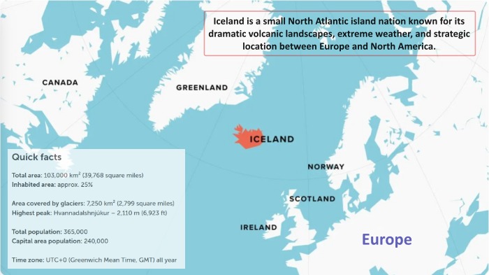
With a population of less than half a million and a remote North Atlantic location, Iceland might appear to be a minor player in global aviation. In reality, its position between Europe and North America gives it an unusually important role in transatlantic air traffic, oceanic air traffic management, aviation meteorology and volcanic-hazard management.
A Strategic Position in the North Atlantic
According to Isavia ANS, the Icelandic air traffic control area covers approximately 5.5 million square kilometres, making it one of the world’s largest control areas. The Reykjavík Control Area is also part of the North Atlantic High Level Airspace (NAT HLA).
Reykjavík ACC provides air traffic services across extensive oceanic airspace, including responsibilities within parts of the Nuuk FIR under international arrangements.
In 2025, 199,640 aircraft passed through the Icelandic air traffic control area, around 67% of them overflights. Isavia also reports that more than one-third of transatlantic traffic between Europe and North America passes through airspace managed by Iceland’s air navigation system. Much of Iceland’s aviation infrastructure therefore supports aircraft that never actually land in the country.
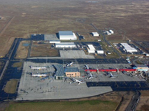
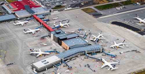
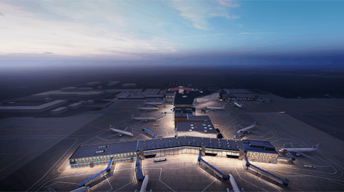
Keflavík: A Strategic North Atlantic Airport
Keflavík International Airport (KEF) reflects Iceland’s unique geography. Originally developed during the Second World War, it later became Iceland’s principal international gateway. Its North Atlantic location and demanding weather conditions have also made Keflavík useful for aircraft testing. ICAO documentation notes its use for icing and crosswind testing, including crosswind tests involving aircraft such as the Boeing 777 and Airbus A380.
Aviation in a Demanding Environment
Operating around Iceland means dealing with strong winds, low cloud, icing, turbulence, precipitation and rapidly changing North Atlantic weather. The Icelandic Meteorological Office provides dedicated aviation services covering TAF, SIGMET, low-level forecasts, icing, turbulence and pilot reports.
But Iceland’s most distinctive natural aviation hazard comes from below the atmosphere.
The country is one of the world’s most volcanically active regions. Volcanic ash can damage aircraft engines and airframes, contaminate systems, affect sensors and reduce visibility.
The Icelandic Meteorological Office is Iceland’s State Volcano Observatory and monitors volcanic activity relevant to aviation. Volcanic ash advisories for Iceland and the northeastern North Atlantic are provided by the London Volcanic Ash Advisory Centre (London VAAC), operated by the UK Met Office under ICAO designation. This creates an international safety system combining volcano monitoring, meteorology, ash-dispersion modelling and air traffic management.
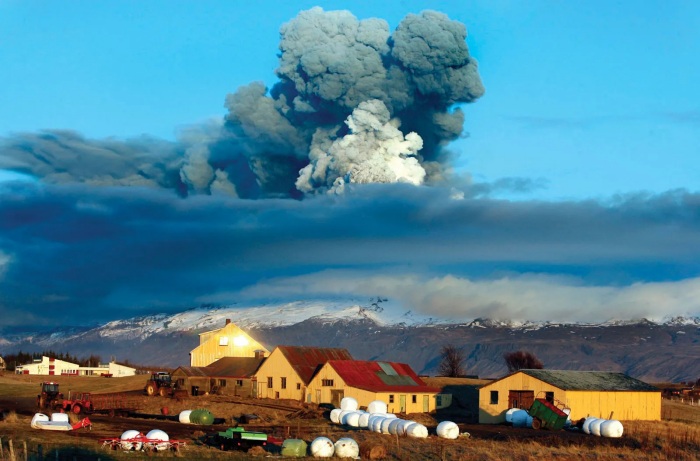
Eyjafjallajökull: A Turning Point
The importance of this system became dramatically clear in April 2010, when Eyjafjallajökull erupted and volcanic ash spread towards some of Europe’s busiest airspace. EUROCONTROL records the progressive closure of large areas of European airspace, while the Icelandic Meteorological Office reports that more than 100,000 flights were cancelled, with estimated airline revenue losses of approximately €1.3 billion.
ICAO described the eruption as an unprecedented meteorological, airworthiness and ATM event. It subsequently contributed to major international work on volcanic-ash contingency planning and cooperation between regulators, scientists, airlines, ANSPs, pilots and manufacturers. The lessons remain relevant today. VOLCEX25, for example, simulated an eruption of Iceland’s Katla volcano affecting North Atlantic and European airspace and tested modern concepts including Dynamic Airborne Reroute Procedures supported by CPDLC.
A Natural Aviation Laboratory
Few countries combine so many aviation challenges in one place: oceanic ATM, transatlantic traffic, severe weather, volcanic hazards and international coordination. Newer risks are also relevant. Icelandic aviation authorities have published specific information concerning GNSS interference, including jamming and spoofing, within Reykjavík CTA.
On a conventional map, Iceland is a small island in the North Atlantic. On an aviation map, it looks very different.
Its controllers help manage an enormous area of airspace connecting Europe and North America; Keflavík occupies a strategically valuable location; and its meteorological and volcanic-monitoring systems operate in one of aviation’s most challenging natural environments. This combination of geography, air traffic management, meteorology and geology gives Iceland a role in global aviation far greater than its size might suggest.
References
- Isavia ANS — Reykjavík Control Area and North Atlantic air navigation services.
- Isavia Group — 2025 air traffic statistics.
- Icelandic Meteorological Office — Aviation weather and volcanic hazards.
- UK Met Office — London Volcanic Ash Advisory Centre.
- ICAO — Volcanic ash and North Atlantic aviation documentation.
- EUROCONTROL — Impact of the 2010 volcanic ash cloud.
- Keflavík International Airport — Airport history and development.