How LIDAR is Making Aviation Safer, More Efficient, and More Innovative
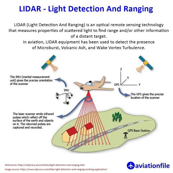
LIDAR, or Light Detection and Ranging, is a remote sensing method that uses laser light pulses to measure variable distances to the Earth. It can be used to create 3D maps of the ground, as well as to detect objects in the air.
In aviation, LIDAR is used for a variety of purposes, including:
To create accurate and up-to-date maps of airports and other aviation infrastructure. This information can be used to improve safety and efficiency.
To detect hazards in the air, such as volcanic ash, microbursts, and wake vortex turbulence. This can help pilots to avoid these hazards and improve safety.
To develop autonomous aircraft and other aviation technologies. LIDAR can be used to provide these systems with the information they need to navigate and avoid obstacles.
Here are some specific examples of how LIDAR is being used in aviation today:
The US Federal Aviation Administration (FAA) is using LIDAR to create new maps of airports and other aviation infrastructure. These maps will be more accurate and up-to-date than existing maps, and they will be used to improve safety and efficiency.
The European Space Agency (ESA) is developing a new LIDAR system to detect volcanic ash in the air. This system could be used to warn pilots of volcanic ash clouds, which can be very dangerous to aircraft.
NASA is developing a new LIDAR system to detect wake vortex turbulence. Wake vortex turbulence is caused by the vortices of rotating air that trail behind aircraft wings. It can be very dangerous to small aircraft, so having a way to detect it could improve safety.
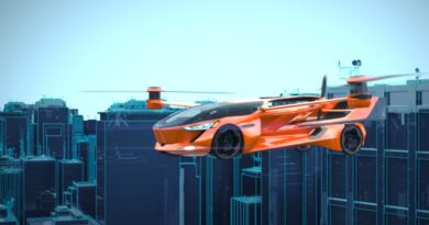
Several companies are developing autonomous aircraft that use LIDAR to navigate and avoid obstacles. These aircraft could be used for a variety of purposes, such as delivering packages or inspecting infrastructure.
LIDAR is a powerful technology that has the potential to revolutionize aviation. As the technology continues to develop and become more affordable, it is likely to be used in an even wider range of aviation applications.
References and Further Reading:
https://science.larc.nasa.gov/lidar/
https://skybrary.aero/articles/light-detection-and-ranging-lidar
https://www.elprocus.com/lidar-light-detection-and-ranging-working-application/
featured image source: https://evrimagaci.org/lidar-teknolojisi-nedir-nasil-calisir-nerelerde-kullanilir-10214