What is ANSP ?
The abbreviation ANSP refers to Air Navigation Service Provider. An air navigation service provider (ANSP) is a public or a private legal entity providing air navigation services. Depending on the specific mandate, it manages air traffic on behalf of a company, region or country. An ANSP provides one or more of the following services to airspace users (Airline companies, Public flights, SAR flights…).

- Air Traffic Management (ATM)
- Communication Navigation and Surveillance Systems (CNS)
- Aeronautical Information Services / Aeronautical Information Management (AIS / AIM)
- Meteorological Service for Air Navigation (MET)
- Search and Rescue (SAR)
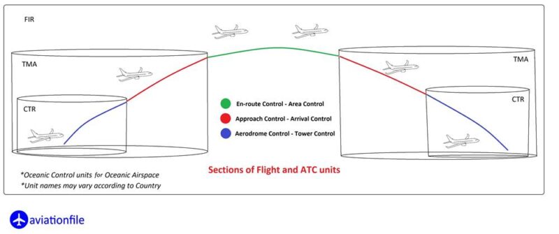
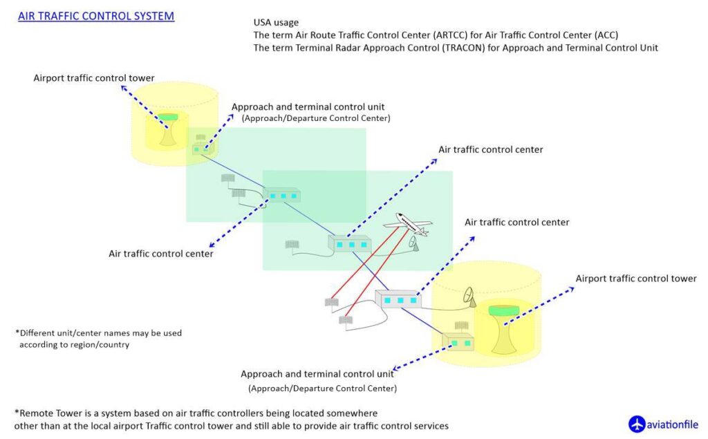
These services are provided to air traffic during all phases of operations (approach, aerodrome and en-route).
Air navigation service providers are either government departments (like DHMI in Turkey, FAA in USA), state-owned companies, or privatised organisations (SERCO). The majority of the world’s Air Navigation Service Providers are members of the Civil Air Navigation Services Organisation located at Amsterdam Airport Schiphol.
Now let’s continue by describing these services.
ATM
ATM is an aviation abbreviation encompassing all systems that assist aircraft to depart from an aerodrome, transit airspace, and land at a destination aerodrome (Sections of a Flight) including Air Traffic Services (ATS), Airspace Management (ASM), and Air Traffic Flow and Capacity Management (ATFCM) (We will not go further details in this article to stay in topic).

CNS
CNS has the following three main functions.
Communication: Communication, i.e. aviation communication, refers to radio communication between two or more aircraft, or the exchange of data or verbal information between aircraft and air traffic control unit. For continental airspace, VHF (civil) and UHF (military) systems are used whereas for oceanic areas, high frequency systems and SATCOMs are used.
Navigation: Navigation, i.e. air navigation, refers to the process of planning, recording, and controlling the movement of an aircraft from one place to another by providing accurate, reliable and seamless position determination capability.
Surveillance: Surveillance systems are used for air traffic control to determine the position of an aircraft.
AIS-AIM
The Aeronautical Information Service (AIS) – Aeronautical Information Management (AIM) is a service established in support of international civil aviation, whose objective is to ensure the flow of information (e.g. flight plan details) necessary for the safety, regularity, and efficiency of international air navigation.
SAR
Search and Rescue (SAR) is the search for and provision of aid to people who are in distress or imminent danger. The general field of search and rescue includes many specialty sub-fields, typically determined by the type of terrain the search is conducted over.
Meteorology
Aviation meteorology is the study of weather from the unique perspective of the aviation industry. The main objective is to contribute to the guarantee of safety standards, economy and efficiency of flights.
Some Air Navigation Service Providers
EUROCONTROL (in some parts of Europe)
FAA (USA)
AVINOR (Norway)
IAA (Ireland)
DHMI (Turkey)
NAV Canada (Canada)
GCAA (United Arab Emirates)
DFS (Germany)
Airservices Australia (Australia)
Airways (NewZeland)
Romatsa (Romania)

For more articles click.


