Common Clouds in Aviation
Clouds in aviation is a vital subject for aviation safety. For both pilots and controllers, clouds are always an updated subject. They can cause to some serious problems on a flight. For pilots and air traffic controllers, it is fair to say that clouds are sometimes like a nightmare.
In a flight, some types of clouds don’t cause problem but some of them like CB’s (cumulonimbus) are serious and they cause reduction on flight comfort, turbulence, deviation moves, rerouting by controllers, more vectoring on that area and more. All that means additional workload and stress. Most importantly they are related with safety issues.
Let’s have a closer look to the most common types of clouds on aviation.
Cumulus:

Cumulus clouds are one of the most common type of clouds. They look like popcorns or like cotton balls and the easiest cloud to draw as a child. To an average person when you ask to draw a cloud it will be look like a cumulus.
For aviation they are low level clouds below 6000’ feet. Top of these clouds are mostly white and rounded, although bottom of them are darker and sometimes has flat shape.
For an aircraft, cumulus clouds can cause turbulence and icing.
Stratus:
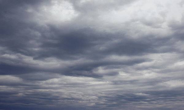
Stratus clouds are low level clouds below 6000’ feet. They are generally dark grey, grey or/and white colour. They cover the sky like straight layers.
Stratocumulus:
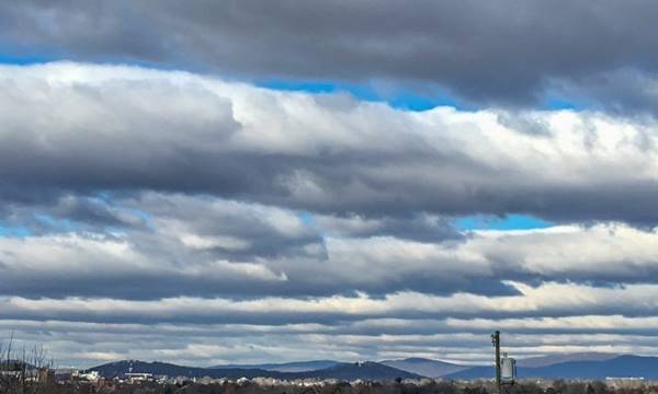
Stratocumulus clouds are low level clouds below 6000’ feet. Their colour may vary from dark grey to white. Some parts can be darker than other parts also there can be gaps between them. You can easily differentiate them from stratus clouds from their rounded cottony shapes.
Altostratus:
Altostratus clouds are mid-level clouds. They are usually thin and layer type. Their colour may vary between grey, white and blue.
Altocumulus:

Altocumulus clouds are mid-level clouds. They look like a group of cotton rolls on the air. Their colour may vary like Stratocumulus. But the individual elements in Altocumulus are smaller than the elements in Stratocumulus.
Cirrocumulus:

Cirrocumulus clouds are high level clouds above 18.000’ feet. They can cover the entire sky. They look like a group of small rounded cottons. Their individual size is smaller than the elements in altostratus.
Cirrus:
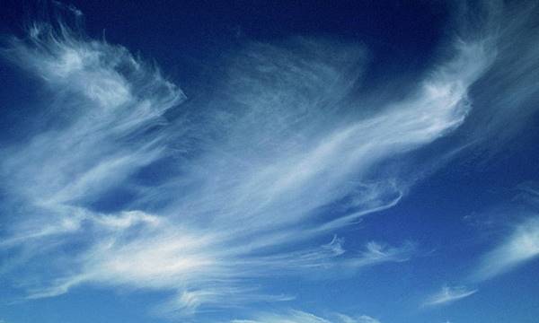
Cirrus clouds are high level clouds above 18.000’ feet. They look like tufts of hair. In daytime, they usually are the whitest cloud. They may take the colours of the sunset when the sun sets or rises.
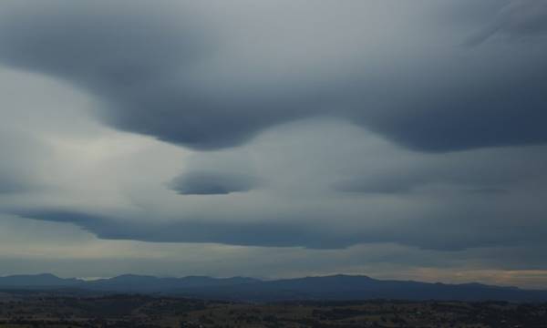
Cumulonimbus:
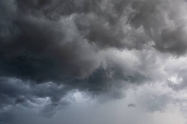
CB (Cumulonimbus) clouds are the most important type of clouds in aviation. They are multilevel clouds. The base of the CB is generally flat and dark and it may start just few hundred feet above the surface of the Earth.
CB clouds are only type that can produce hail, thunderstorm and lightning.
CB effects on aviation
Due to the vertical movement of the cloud (up to 50kt) and difference between updrafts and downdrafts, wind shear and turbulence are expected.
At higher levels of CB, icing from moderate to severe can be expected.
Aircraft flying in the vicinity of a CB may expect electrical distortions. And they are at risk of a lightning hit.
Hail in a CB or on the vicinity of a CB may cause structural damage to the aircraft.
for more article click